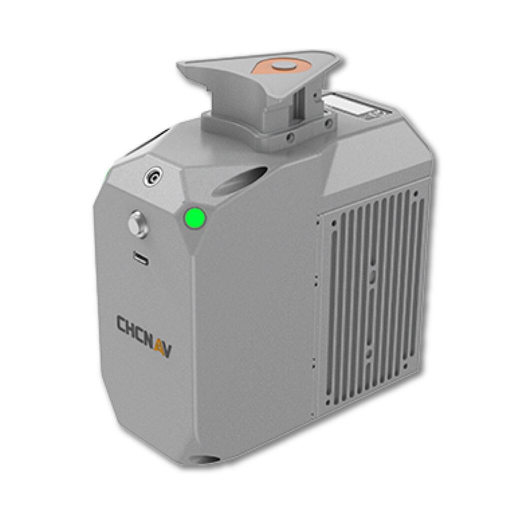
Detailed Overview
The AlphaAir 450 stands at the intersection of feather-light design and industrial-grade performance, setting a new benchmark for UAV-mounted LiDAR systems. Built around the Livox Avia scanner and paired with a high-resolution integrated camera, the AA450 pushes efficiency to the forefront, because every gram matters when your payload takes to the sky. A lighter system means longer flights, wider coverage, and ultimately sharper productivity on every mission.
Armed with the Livox Avia’s long-range capabilities, the AA450 reaches out to 450 m while maintaining remarkable point density across the landscape. From an altitude of 100 m, flying at 10 m/s, a single mission with a DJI M300 and the AlphaAir 450 can map roughly 2 km² with density exceeding 200 pts/m², capturing fine surface detail with ease.
Accuracy sits at the core of the AA450’s architecture. A robust GNSS system and high-precision IMU work together to ensure the point cloud isn’t just rich, but reliably anchored in space. This synergy enables absolute accuracy in the 5–10 cm range, with CoPre software offering refinement algorithms for even greater precision when required.
Flexibility is another hallmark of the system. Its built-in Skyport interface provides seamless plug-and-play integration with the DJI M300, while mounting options allow it to operate effortlessly on CHCNAV’s BB4, VTOL platforms, and a wide range of third-party UAVs capable of carrying its weight. Whether multi-rotor or fixed-wing VTOL, the AA450 adapts without resistance.
Engineered for real-world demands, the system delivers IP64-rated protection and an operating range from –20°C to +50°C, ensuring dependable performance regardless of weather or site conditions.
More than just another LiDAR payload, the AlphaAir 450 marks a pivotal step in making advanced 3D mobile mapping accessible. It brings high-end capability to users who previously found the technology too costly or complex, delivering power, precision, and practicality in one breakthrough solution.
Top Features & Benefits
LIVOX AVIA Scanner
Long-range scanning up to 450m.
26 MP Camera
High-resolution imaging.
GNSS + IMU
High-precision inertial navigation.
Skyport Interface
Easy integration with DJI and other UAVs.
Primary Uses & Functions
A drone-based system for advanced inspection and 3D data acquisition, specializing in capturing highly accurate spatial and visual information of industrial assets.
Use Cases
- Topographic Mapping
- Mining Site Surveys
- River and Watershed Mapping
- Infrastructure Inspection
Industry Solutions
- Oil & Gas (Asset and facility mapping)
- Petrochemical (Facility integrity management)
- Railway (Corridor and infrastructure inspection)
- Mining (Surveying and stockpile management)
- Power Generation (Utility tower, line, and solar farm inspection)
- Wind & Solar (Blade and panel inspection)
- Manufacturing (Large facility and roof inspection)
Technical Specifications
| Absolute accuracy |
<10 cm Hz
<5 cm V |
| Accuracy conditions |
Without control points, @50 m flight altitude AGL |
| Mounting |
Skyport for DJI M300
External power source with the dedicated port for other UAVs (CHCNAV Alphaport interface) |
| Weight of instrument (1) |
0.95 kg |
| Dimensions of instrument |
12.8 x 12.8 x 6.75 cm
5.04″ x 5.04″ x 2.65″ |
| Communications |
1x port for GNSS antenna Skyport interface
1x USB Type-C, copy speed up to 160 Mb/s |
| Data storage |
256 GB |
Point density on UAV setup
5 m/s (18 km/h) speed |
570 pts/sqm @ 50 m AGL
280 pts/sqm @ 100 m AGL |
| Covered area |
2 km² area by 30 mins UAV flight |
| Operation |
One-touch acquisition or remote control via DJI M300 Smart controller enterprise |
| Transport box |
1x protected soft bag with custom precut foam |
| Laser class |
1 (in accordance with IEC 60825-1:2014) |
| Max. range, reflectivity > 80% (2) |
450 m |
| Max. range, reflectivity > 10% (2) |
190 m |
| Max. returns supported |
Up to 3 |
| Accuracy (3) |
20 mm @ 20 m
30 mm @ 100 m |
| Precision (4) |
15 mm |
| Field of view |
70.4° (Horizontal) × 4.5° (Vertical) |
| Scan rate |
240 000 pts/sec (first or strongest return)
480 000 pts/sec (dual return)
720 000 pts/sec (triple return) |
| GNSS system |
Dual-frequency GNSS GPS, GLONASS, BeiDou, Galileo, sampling frequency 5 Hz |
| IMU update rate |
500 Hz |
Position accuracy
NO GNSS outage |
0.010 m RMS horizontal,
0.020 m RMS vertical,
0.01 degrees RMS pitch/roll,
0.04 degrees RMS heading |
| Camera type |
Built-in calibrated Camera |
| Resolution |
6252 × 4168 |
| Effective pixels |
26 MP, 30 fps |
| Min. trigger interval |
0.6 sec |
| Operating temperature |
-20°C ~ +50°C |
| Storage temperature |
-20°C ~ +65°C |
| IP rating |
IP64 |
| Humidity (operating) |
80%, non-condensing |
| Input voltage |
DC 12 ~ 14 V |
| Power consumption |
32 W, min. 2A |
| Power source |
Depending on UAV battery, or by Skyport from DJI M300 |
| * Specifications are subject to change without notice |
Compatibility
- Suitable for large-area and infrastructure mapping/inspection (e.g., power lines, surveying).
- Supports advanced payloads including high-resolution visible light, thermal, and LiDAR (Light Detection and Ranging) systems via proprietary or universal gimbal mounts.
- Data is compatible with industry-standard GIS and 3D modeling software (e.g., AutoCAD, ArcGIS, Pix4D).
What’s In The Box?
- Professional multi-rotor drone airframe (UAV).
- High-performance GNSS positioning module (RTK/PPK base station often separate).
- Remote control unit and communication links.
- Integrated or interchangeable sensor payload (e.g., LiDAR unit).
- Set of high-capacity flight batteries and charger.
- Essential tools and rugged protective case.
Also Known As
UAV NDT Platform, Industrial Quadcopter, Asset Scanner, Airborne Mapping System, LiDAR Drone
FAQ: Alphaair 450 – Inspection Drone System
What is the focus of the Alphaair 450 drone?
The Alphaair series often focuses on high-precision mapping and inspection in challenging, wide-area environments, with 450 likely indicating a model with a high payload capacity or range.