GammaTec Navigation
Your One Stop NDT Equipment Supplier
Office Hours: 7am-5pm Mon-Thu 7am-4pm Fri
GammaTec Mobile Navigation

CHC Navigation

  • Home
  • Brands
  • CHC Navigation
GammaTec Product Sidebar

CHC Navigation

Transform raw drone data into actionable 3D reports for efficient asset integrity management. Coprocess is a comprehensive Drone Inspection Software System designed for processing, analyzing, and reporting data collected by industrial inspection drones (e.g., X500). It provides 3D mapping, measurement tools, and automated defect localization. The platform allows for the efficient management of large datasets, facilitating collaborative review and the creation of detailed, geo-referenced inspection reports, ultimately streamlining the integrity management workflow. Supplier: CHC Navigation
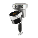
The RS10 is a next-generation surveying solution that seamlessly integrates GNSS RTK, PPK laser scanning, and visual SLAM technologies into a single, powerful platform. This advanced fusion delivers exceptional efficiency and accuracy for both indoor and outdoor 3D scanning and surveying tasks. Supplier: CHC Navigation
Efficiently cover large areas to create accurate 3D models for surveying and construction analysis. The Alphaair 10 is an Inspection Drone System optimized for photogrammetry and 3D modeling applications, especially in mining, construction, and surveying. It is known for its high efficiency in covering large areas, thanks to a robust flight platform and professional-grade camera stabilization. The system provides centimeter-level accuracy in mapping by integrating with advanced GNSS technology, offering a complete, reliable, and user-friendly solution for creating detailed digital twins. Supplier: CHC Navigation
The AlphaAir 450 strips away complexity and opens the door to high-accuracy geospatial reality capture for newcomers and non-specialists. Blending an approachable workflow with impressive precision at an accessible price point, the AA450 delivers professional-level performance without the learning curve. Its lightweight, rugged design houses a powerful laser scanner, a 26 MP industrial-grade camera, and a finely tuned inertial navigation system, working together to produce clean, reliable, high-quality data every time. Supplier: CHC Navigation
The CHCNAV X500 rotor UAV is a professional drone engineered for exceptional payload capacity and endurance. Equipped with advanced flight controls and high-precision positioning, it delivers superior maneuverability, stability, and flight performance. Its built-in visual SLAM and obstacle detection radar ensure intelligent, safe operations. Compatible with CHCNAV sensors and third-party payloads, the X500 is ideal for applications such as surveying, urban surveillance, emergency scouting, disaster relief, and inspection missions. Supplier: CHC Navigation
The AlphaAir 9 stands as a refined aerial mapping system, fusing LiDAR and RGB imaging to deliver professional-grade UAV LiDAR surveying and photogrammetry. Built on CHCNAV’s advanced LiDAR technology, it combines high-accuracy LiDAR, GNSS positioning, IMU orientation, and an industrial orthophoto camera in one unified platform. When paired with CHCNAV’s point cloud and image fusion software, it offers a survey-level, efficient, and cost-effective path to 3D data capture and processing. In a single flight, the AA9 gathers precise 3D information and streamlines the journey from data collection to a true-to-life 3D model. Supplier: CHC Navigation
Gammatec Contact Block

Need Assistance or Looking for Something Else?

Our team of Non-Destructive Testing experts is ready to help you find the perfect equipment and solutions tailored to your specific industry requirements.